CEEn 414 - Civil Engineering Applications of GIS

![]()
![]()
![]()
![]()
![]()
![]()
![]()
![]()
|
CEEn 414 - Civil Engineering Applications of GIS
|
|
|
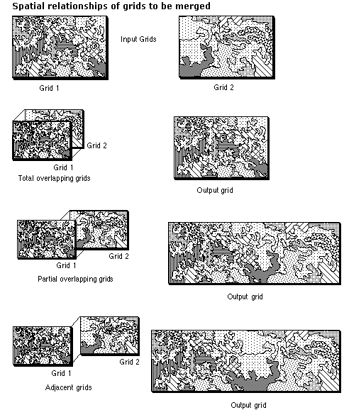
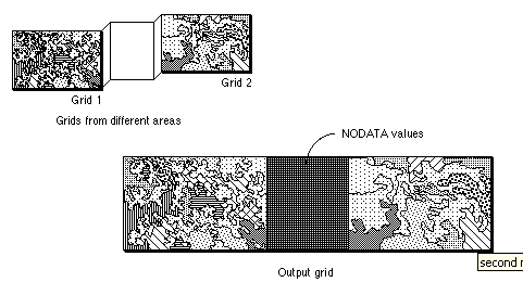
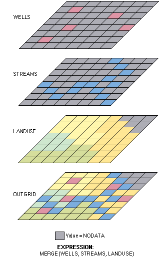
How Merge worksMerge can be used to spatially append or mosaic grids of different map extents, however, these have to be in the same coordinate system. The grids can be totally overlapping, partially overlapping, adjacent, or entirely separated. If the input grids overlap, the order of precedence is defined by the order of the grids in the argument list. When the input grids overlap, they are viewed as a set of layers where NoData is transparent. The output grid receives the first value at each cell that is not NoData. For a set of overlapping grids, a number can be entered as valid input, but this input should be the last one in the list, since it will populate the remainder of the grid. The Merge function itself will not interpolate to fill missing data between adjacent grids. The following Map Algebra expression may help to solve the problem by interpolating values of the missing cells. It will fill gaps of up to three rows or columns of NoData cells (the length of the gap is unrelated) with the mean cell value of the 4-x-4 square, leaving the valid existing data unchanged. If the gap is wider than three cells, the size of the focal window may be increased.
If the gap needs to be eliminated from the mosaic made up of categorical grids, the following approach may be useful:
|